EO Browser officially launched at the World Cover conference
A free satellite imagery visualization tool - EO Browser - provides immediate and full resolution insight into all European Space Agency (ESA) optical missions' data - more than 30 years of data in Europe and several years of worldwide coverage. It was developed in close cooperation with ESA and launched at the World Cover conference on March 16, 2017. Read more
To access standard functions you don't even need to register. Explore a complete archive of Sentinel-2, Sentinel-3, ESA’s archive of Landsat 5, 7 and 8, global coverage of Landsat-8, and Proba-V products in one place. Try EO Browser yourself or contact us for more details.
Many remarkable features such as comparison of data to easily identify changes, various visualization options (true color, false color, NDVI, etc.), custom band combinations and even some data processing mechanisms, allowing users to run classification scripts are available for registered users. EO Browser is a perfect tool to find relevant satellite images and prototype various pixel-based algorithms as well. Contact us for a trial account!
Free research accounts for Sentinel Hub @ EO Cloud sponsored by ESA
Good news for all the researchers and scientists out there. The European Space Agency (ESA) has opened a call to provide 100 free accounts for R&D projects to OGC EO Interface Integration Service, which can be accessed up to March 2018. The service facilitates the access to free online optical data and allows their dynamic integration into higher level services.
The current access to Sentinel-2, Sentinel-3, Landsat 5, 7 and 8 (ESA's archive) will be soon enriched with a full global archive of ENVISAT / MERIS.
Use this opportunity to build your own application on top of Sentinel Hub services. Interested? Get more information here.
Sentinel-3 data recently integrated into Sentinel Hub
Our recent integration of Sentinel-3 mission made it possible to combine Sentinel-2 with a bit less detailed but higher frequency data - at European latitudes it is possible to get a new image almost every day. Get more details here...
You can access the Sentinel-3 imagery with EO Browser or Sentinel Hub WMS/WCS services.
ESA Director General Johann Dietrich Wörner visited Sinergise
Last month we've had an honor to host Mr. Wörner at our headquarters in Ljubljana, Slovenia. The main discussion points were focused on how ESA is helping small companies like Sinergise, to become champions of the space race, as well as what could be improved in the process. Read more about the visit here.

Ad hoc testing of algorithms globally
By employing the dynamically interpreted JavaScript language, Sentinel Hub API supports ad hoc combination of the multispectral satellite data in unprecedented ways. The code is evaluated on-the-fly, which means that it can be visualized on a complete dataset (globally over whole archive). Testing your (pixel based for now) algorithm has never been simpler, nor faster.

Prototyping pixel-based algorithm on EO Browser: a decision tree from A. Hollstein et al. (top left) is coded into a custom script (top right), and immediately visualized in the EO Browser (bottom).
Check our latest blog for examples.
Shaving seconds off the response time
With an optimization of the infrastructure in February we shortened the response time of Sentinel Hub services for 0.5 - 1 second. The optimization was done just in time before a huge wave of requests from Estonia triggered by the Estonian Maritime Administration Veeteede Amet’s Facebook post.

Do you want to know more about the optimization? Click here.
Sentinel Hub with Landsat 8 worldwide coverage
After successful integration of USGS Landsat satellites' data into Sentinel Hub (in addition to previously accessible ESA Archive of Landsat 5,7 and 8 for Europe and North Africa), you can now access Landsat 8 worldwide, using Amazon's open public dataset programme - Earth on AWS.

Data can be easily and effortlessly accessed with our Image Browser, which allows you a comparison between different images of the same area of interest. Read more!
Statistical info API
The Statistical info API performs elementary statistical computations – such as mean, standard deviation, and histogram approximating the distribution of reflectance values – on remotely sensed data for a region specified in a given spatial reference system across different bands and time ranges. A quintessential usage example would be querying the service for basic statistics and the distribution of NDVI values for a polygon representing an agricultural unit over a time range.
The service retrieves all data from the given time range that fit the prescribed criteria, computes statistics on these data, and returns the result in the form of a JSON object. More information on FIS can be found here!

Violin plot showing distribution of NDVI values in a given region across time ranges.
Sentinel Satellite Imagery for IACS controls
Satellite imagery is revolutionizing agriculture and can help European farmers and public authorities take land monitoring to a new level. While Common Agricultural Policy (CAP) requires member states to perform diligent checks of subsidized agricultural parcels, satellite imagery can help automate or reduce workload of several tasks in IACS, thus lowering the cost of the inspection process.
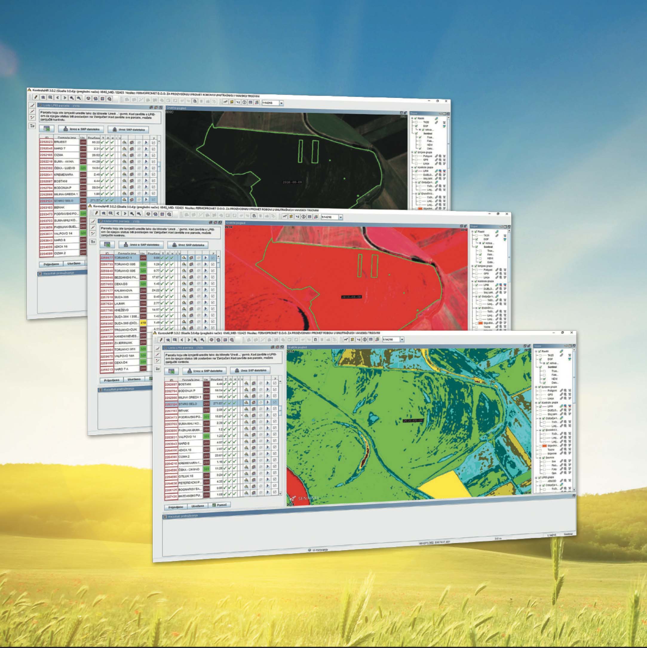
Sentinel Hub is exploiting advance cloud technology and innovative methods to efficiently process and distribute data in a matter of seconds, and makes satellite data (Sentinels, Landsat and other providers) seamlessly accessible for you to be browsed or analyzed within your own GIS environment. There are several more benefits of Sentinel data for IACS controls:
- Managing complaints in a more transparent manner.
- Easy observation of cultivated areas through the year.
- Better insights with the use of multi-spectral imagery (e.g. stubble and catch crops).
- Advanced possibilities like land use and crop classification.
Artistic images in Sentinel Playground powered by Deepart
All art lovers, don't miss this new feature recently added to Sentinel Playground. With "Artistic Effects" powered by Deepart and inspired by William Morris you will be able to put an artsy twist on satellite imagery. Read more about how to create your own stunning art here.